The raccoons were quieter last night. Either that or I was so exhausted I slept through them. When we wake up we see more of those big, dark, roiling clouds heading towards us. Weather alerts are showing 80% chance of severe thunderstorms for the area. The fateful decision is made. After breakfast we break camp and prepare to head home. No real point in staying another day/night if all it's going to do is rain and packing up while raining is suckage in the extreme, nevermind having to haul everything back out later to get cleaned and dried.
Everything comes down pretty quickly. Shaking the tent cover off and spraying everyone gave the neighbors some entertainment for the morning. Surprisingly I manage to stuff the tent and cover into the zip case for it. I'm going to have to find a better solution. Thinking perhaps some of those old swedish duffel bags I have. Those would be just about the right size. Some re-arranging of supplies was needed but everything fit back in the van just like it should. I even added a few square inches for the kids to move around.
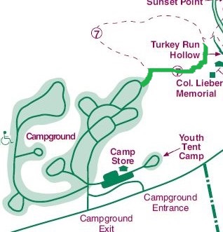
Since it's still early, I suggest that we hit one more short hike. Trail 7 is right off the campground, rated 'moderate' and not even 3/4 of a mile. Perfect way to close out the trip. I go w/ (slightly damp) sneakers and socks since the blister on my foot is really smarting and I'm not expecting any water wading. I also pull out my newly acquired hiking stick that I picked up from the camp store. Finally, after years of wanting one, I found one that struck me. Not literally, but it felt like it. The one that as soon as I saw it I went "Yep, that's the one".
Apparently the word 'Moderate' has a different definition in Indiana than it does in Illinois.
We enter the trail and take the right fork. From there the trail just drops and then turns into near vertical rock steps and steep wooden steps for about a 1/4 mile until it reached the bottom of a ravine. "Moderate" my @ss.
Down at the bottom was a nice pool at the bottom of a small waterfall and bowl that the kids played in for quite a while. The view was spectacular.
After the bit of play and much splashing, we started heading down the ravine. It was hazy and really pretty. Shortly in though, we ran into a pair of hikers, father and son, who told us the way was flooded out a few hundred yards further in. We decided to go as far as we could.
Now when we got to the flooded out area the view was breathtaking. Through pure luck, I took some of the best photos I've ever done.
Seriously, I love these pictures. I couldn't repeat it if I tried.
After this we turned around and headed back. Tentatively thinking of going the other direction of the fork, when we got back to the top,our legs were just about done. Time to head back and out.
We hauled ourselves to the van, sucked down some cool drinks, and said goodbye to the campsite. Depositing our tag into the box, we hit the road and headed home. On the way, the A/C caused my calves to cramp up. It was really not easy to walk when we got back. The kids hauled everything out of the car and we got the cooler food into the fridge/freezer. They became supper for the next few days.
Of course we picked up a few souvenirs. I found some patches (the only place selling them was the Inn), pin, and a 'medallion' for the hiking stick.
We are so going to do this again.